
Linn County ZIP Directory Coverage
The official Iowa DPS table identifies 31 entries coded to Linn County. Most are standard delivery areas. Troy Mills has a post-office-box designation, five Cedar Rapids codes serve boxes, and three Cedar Rapids codes are unique. A postal city is a mail label, not proof that each address lies inside that city's legal border.
| ZIP | Areas covered | Postal label | Type |
|---|---|---|---|
| 52202, 52213, 52214 | Alburnett, Center Point, Central City areas | Same named cities | Standard |
| 52218, 52219, 52227 | Coggon, Prairieburg, Ely areas | Same named cities | Standard |
| 52228, 52233, 52253 | Fairfax, Hiawatha, Lisbon areas | Same named cities | Standard |
| 52302, 52314, 52324 | Marion, Mount Vernon, Palo areas | Same named cities | Standard |
| 52328, 52336, 52341, 52352 | Robins, Springville, Toddville, Walker | Same named cities | Standard |
| 52344 | Troy Mills | Troy Mills | P.O. Box |
| 52401-52405, 52411 | Cedar Rapids delivery areas | Cedar Rapids | Standard |
| 52406-52410 | Cedar Rapids boxes | Cedar Rapids | P.O. Box |
| 52497-52499 | Single-customer designations | Cedar Rapids | Unique |
The table is not a parcel boundary file. Nearby codes assigned to Atkins, Shellsburg, Walford, Swisher, Martelle, Monticello, Solon, Anamosa, Mechanicsville, Stanwood, and Amana may touch Linn County. Check an edge address on the official county ZIP map and through USPS. No single official source paired every code with a station address and hours.
Linn County Postal Lines Differ
Linn County has 18 incorporated cities, but postal geography does not grant each one a separate code. Bertram has no Linn-coded row in the DPS table. Walford is tied to Benton County in that table even though Linn County maps supply local city context. A rural mailing label may therefore differ from the municipality, assessor district, voting precinct, school district, or E-911 authority.
A ZIP, assessor owner, or voter record does not prove current residence. Situs, mailing, registration, and record-party addresses serve different purposes. Preserve each value and its source date rather than forcing them into one address.
Boundary check. Treat a ZIP as mail-routing evidence, then use GIS and E-911 records to establish physical jurisdiction.
GIS Filters Linn County ZIPs
The Linn County GIS parcel layer exposes a real Situs Zip field. It can return geometry, GPN, situs address, legal description, owner deed or contract, and recorder links. This makes GIS the best local ZIP-wide property mode. The service supports filters, distance queries, statistics, pagination, and a maximum selection of 2,000 records.
| Field | Use |
|---|---|
| Situs Zip | Filter by the parcel's physical ZIP |
| GPN | Carry a stable parcel ID forward |
| Situs Address / City | Check the physical place |
| Owner Deed / Contract | Read an ownership role, not occupancy |
| Recorder Instrument Number | Open the recorded-document trail |
The successful capture comes from the official GIS query endpoint.
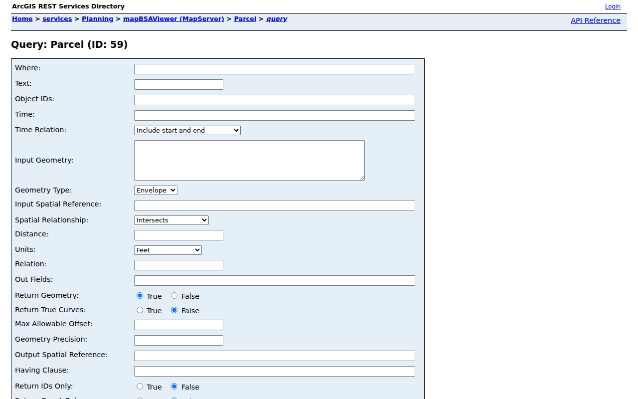
The field list separates a supported parcel result from a broad assumption based on the postal label.
Find Linn County Residents by ZIP
A ZIP code directory does not produce one public roster. GIS can select parcels by physical ZIP. Iowa's voter tool uses a ZIP with first and last name to verify a known registration and polling place. The assessor forms reject city and ZIP in their address boxes. USPS confirms postal form but warns that its result does not show who occupies an address.
- Check the city and code with the USPS ZIP Code Lookup.
- Filter county GIS on
Situs Zip, then save the GPN and exact physical address. - Choose the county assessor or separate Cedar Rapids assessor based on parcel jurisdiction.
- For a known person, enter first name, last name, and ZIP in Iowa's voter lookup.
- Once a code narrows to one road, use the Linn County street directory.
A county voter-list request is separate from the instant lookup. It needs a signed lawful-use certification, payment, and can take up to 14 days. Election Services also assists by phone at 319-892-5300.
Linn County Assessor ZIP Limits
The county and Cedar Rapids assessor searches say not to enter city or ZIP with the physical address. Both accept PIN, house number and street name, legal description, and acreage. The county form adds section, township, and range. The city form adds DBA. Neither inspected form displayed an owner-name field.
Start with the ZIP slice in GIS, then carry the GPN into the correct assessor. County-assessed property support is available by phone at 319-892-5220. Cedar Rapids parcels go to the city assessor. An assessment owner still does not prove who occupies the site now.
Note: A ZIP-wide assessor attempt fails when the code is added to a field that expressly expects only house number and street.
Linn County Voter ZIP Check
The Linn County voter and polling lookup connects readers to registration and polling details. The state search asks for first name, last name, and ZIP. It checks a supplied identity. It does not publish all people within a code.
The successful manifest image shows the county election lookup route and its role as a verification step.
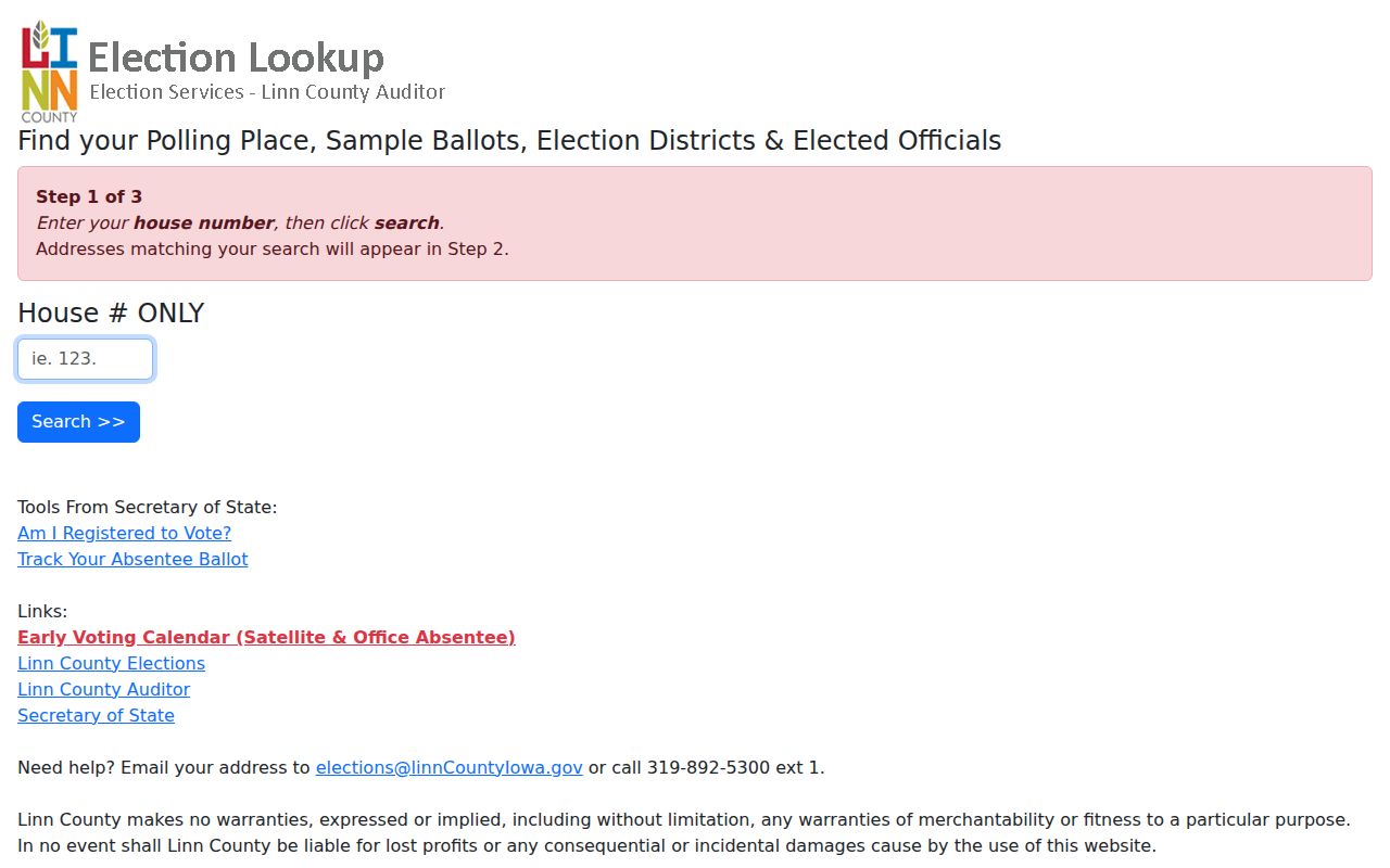
Use the screen after a likely name and code are known, not as a stand-alone resident list.
Verify Linn County Rural ZIPs
Rural edge addresses need an address-level evidence stack. Begin with USPS for the current mail form. Compare the county ZIP map, which also shows roads and city boundaries. Then query the GIS parcel's situs ZIP and GPN. If the physical address is unclear, Linn County Engineering and Secondary Roads is the E-911 custodian for unincorporated property. Historical directories and maps should handle older forms because no official Linn County ZIP realignment chronology was located.
The access route remains open when a web map fails. GIS publishes a free data repository after account creation, maintains a limited-data route through a sharing agreement, and provides phone help. The assessor has online, counter, and phone channels. Election Services can explain a known registration check or the separate voter-list request. Libraries and the History Center hold maps and directories that add a date to postal evidence.
A focused Iowa Code chapter 22 request can ask the proper custodian for a defined ZIP or address layer, its date, and field definitions. Ask for one code, boundary, or record range rather than every record tied to a person. The answer may carry a fee or redaction, so request an estimate first.
Note: Save each source date because county GIS layers are refreshed on a weekly cycle and postal assignments can change.
Linn County ZIP and City Limits
The county map, USPS result, GIS situs field, and E-911 address answer different questions. USPS routes mail. GIS places a parcel. The assessor establishes assessment jurisdiction. E-911 maintains an emergency address. For unincorporated Linn County, Engineering and Secondary Roads issues E-911 addresses and can be reached at 319-892-6400.
- ZIP and ZIP+4
- A delivery area versus a more precise add-on for a segment, building, or box group.
- P.O. Box ZIP
- A designation for post-office boxes rather than normal street delivery.
- Unique ZIP
- A code assigned to one high-volume organization or institution.
- Carrier route
- The path followed by a postal carrier, which can cross civic boundaries.
No official Linn-specific realignment history was found. To date an old address, use a period directory or map rather than projecting the present code backward. County GIS offers online data and phone help at 319-892-5250. A narrow Iowa Code chapter 22 request can seek a county ZIP or address layer when the portal is not enough.